Productive Defense: A Master Plan for Nansha Coastline
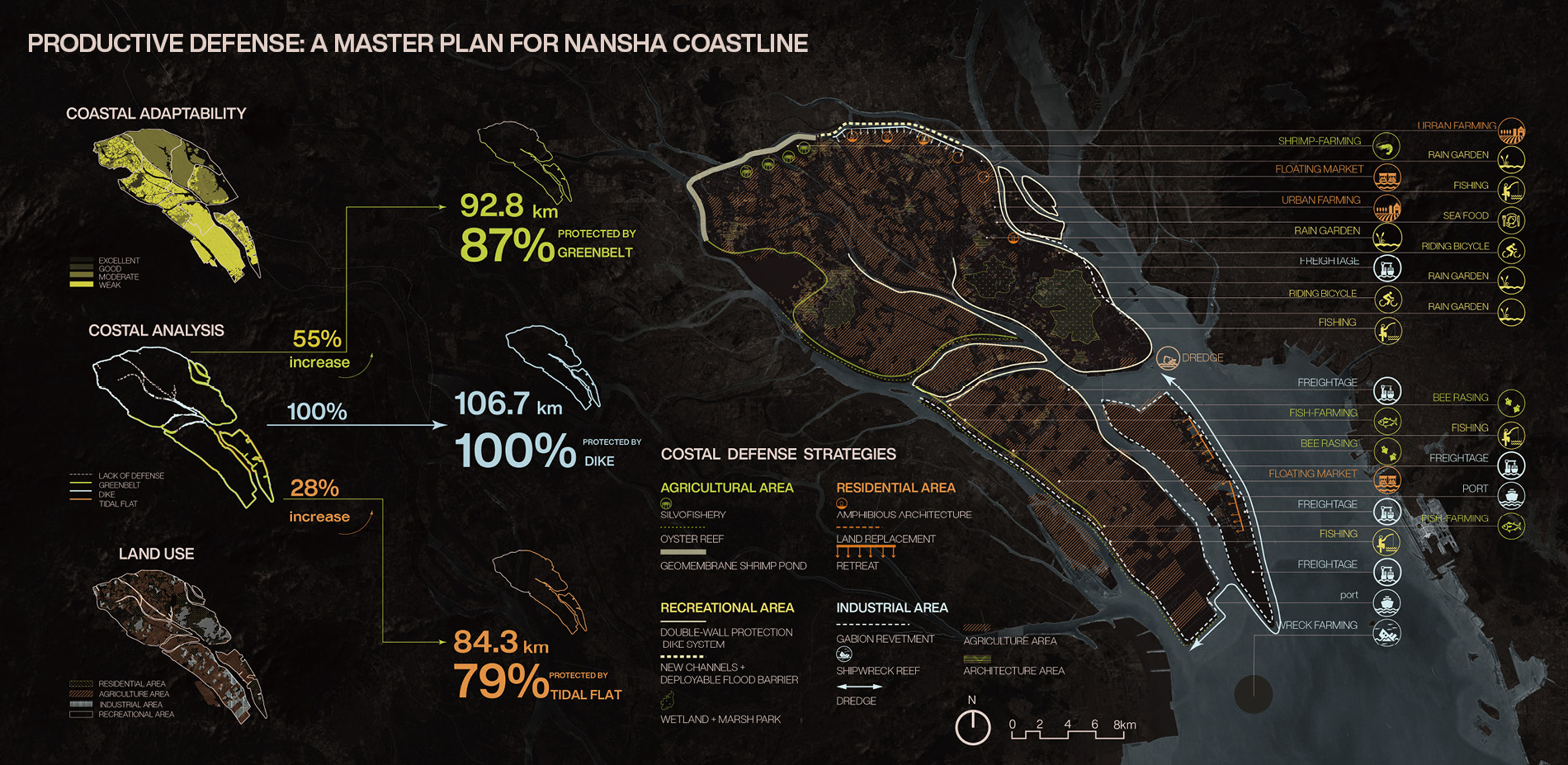
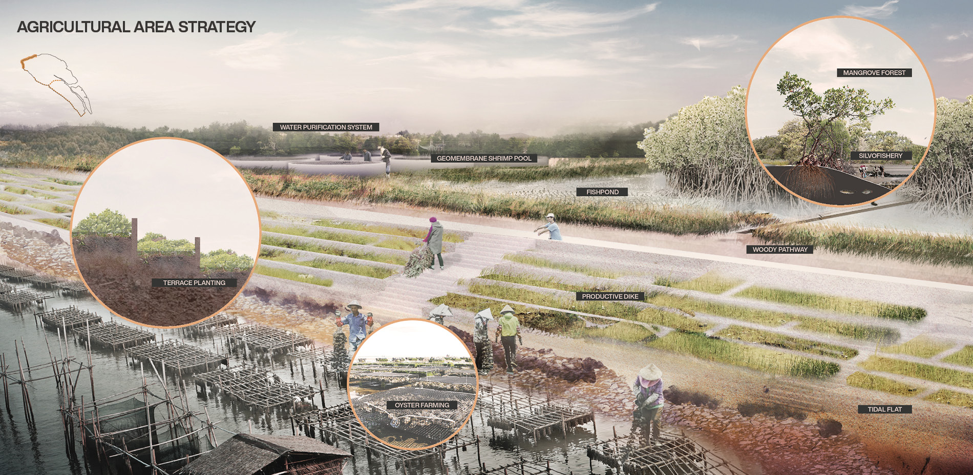
Nansha, located at the estuary of the Pearl River Delta, is a landscape resource system dominated by agricultural production, in which aquatic production accounts for 33.27%.
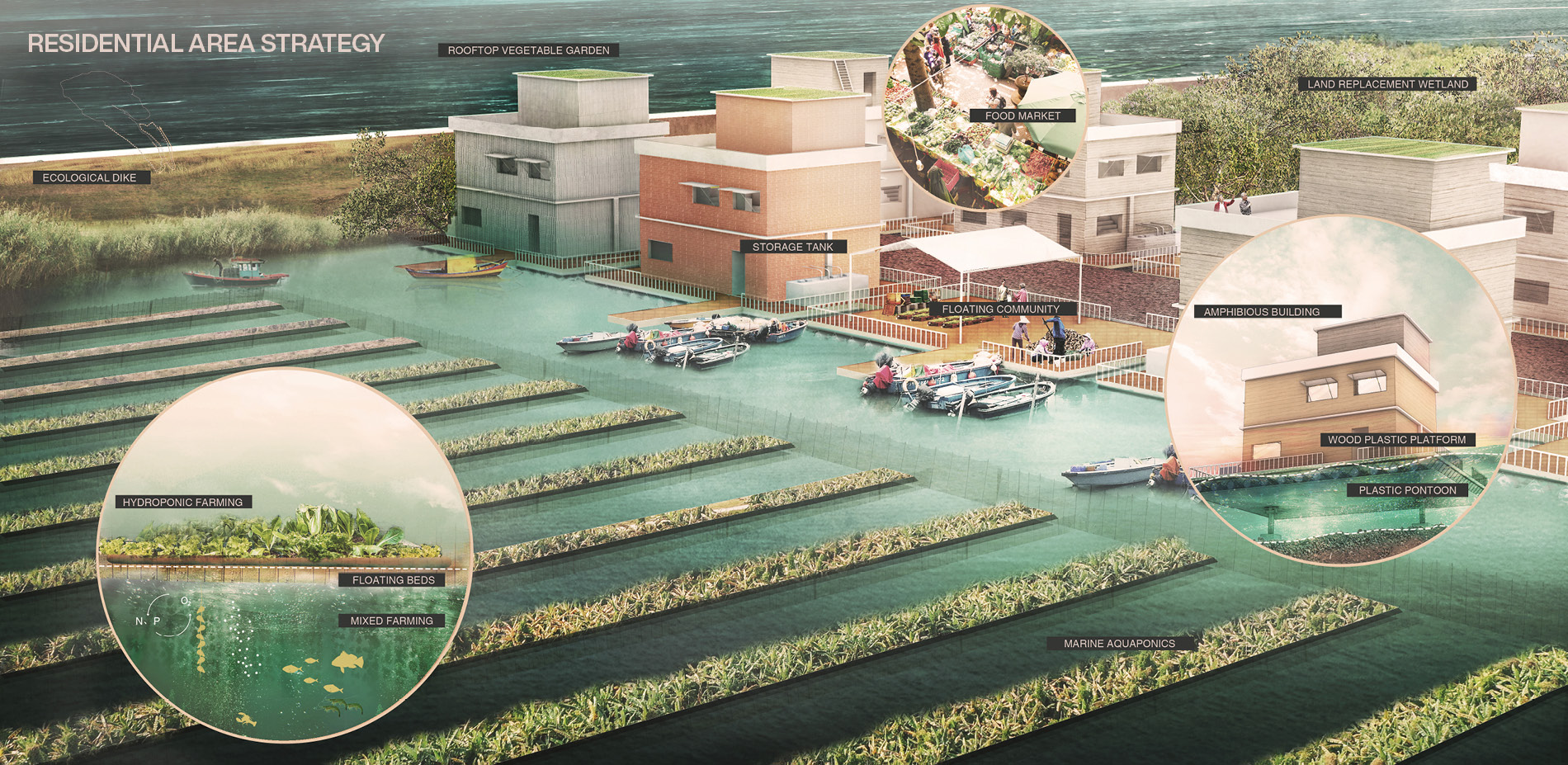
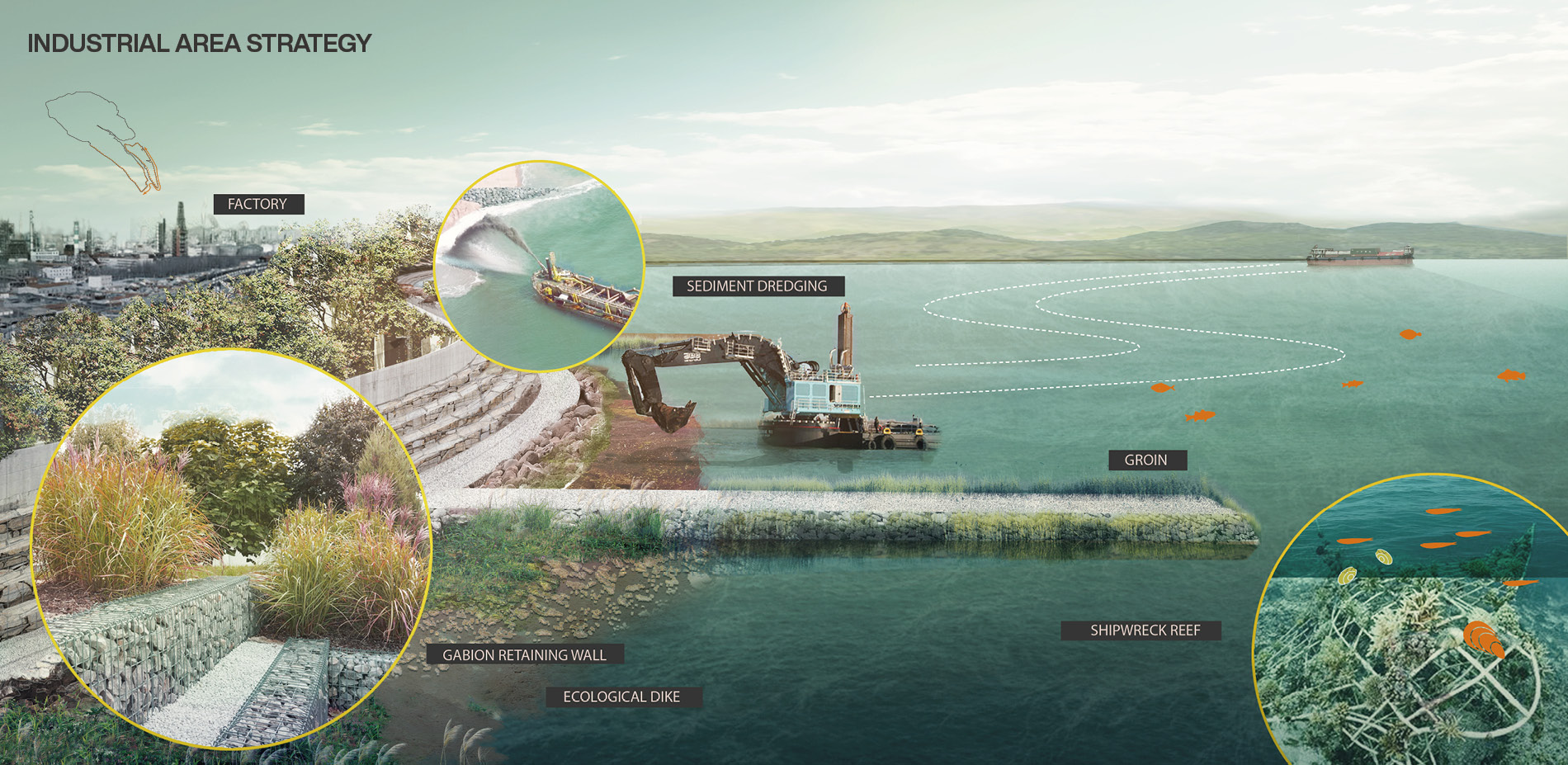
The present defense mostly relies on dikes. Mangroves can cope with current coastal risks, but not enough with future threats. Meanwhile, the fragile ecosystem and the increasingly dense population in Nansha are sensitive to SLR and storm surge risks. When sea level rise coupled with a 200-year storm surge reaches 4.2m in 2100, according to the IPCC, over 80% of agricultural land in Nansha will be inundated, causing an economic loss of over 100000 USD. How to build a coastal defense system to deal with coastal risks while developing aquaculture, especially shellfish production?
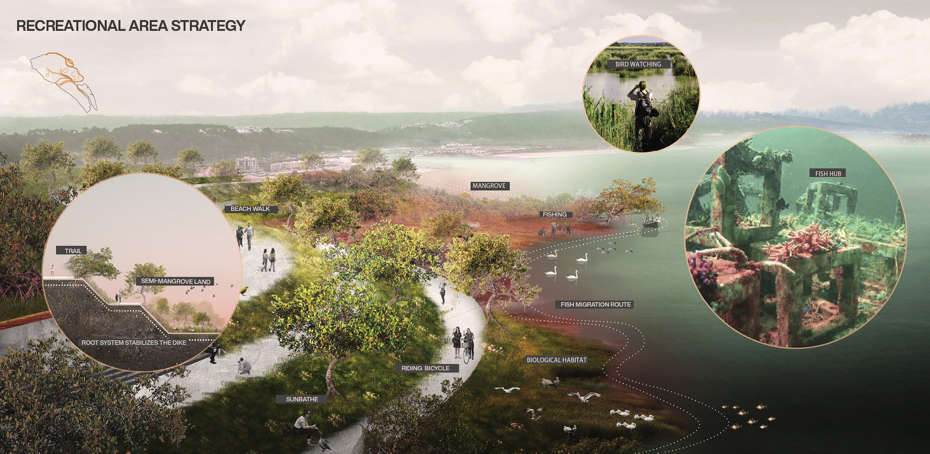
The research group focuses on the assessment of coastline resilience, aiming to enhance the overall adaptability through improving the ecological, productive features, and defense capability of coastlines. After analyzing the characteristic of the coastline in 4 levels of adaptability: the high resilience coastline is protected by mangrove and dike, the medium resilience coastline is protected by mangrove only, the low resilience coastline can only rely on the dike, while the very low resilience coastline lack of coastal defense. Incomplete protection leaves unpredictable risks for future coastal hazards, and simple protection elements have sterilized a living system.
项目地址/Location:Nansha, Guangzhou
项目面积/Area:783.86 km²
设计年份/Year: 2021
负责人/Lead Designer:Chongxian Chen
成员/Team:Peiyao Xiao, Lanxing Yu, Guoyi Wang, Fangyu Huang, Xushan Liu